In Ghana much like anywhere in the world, processes governing land cover change are representations of complex interactions between extant biota, human-mediated modifications, variations in climate and landscape physiography, and land use legacies that can stretch for decades in history. In certain locations in Ghana however, landscapes may be changing in ways that might not be conducive to supporting ecosystem services that are critical to supporting human activities and/or the integrity of natural ecosystems. Unmitigated, these changes can be deleterious to the sustenance of critical processes over time. This is especially true in light of recent climate change and population growth and migration.

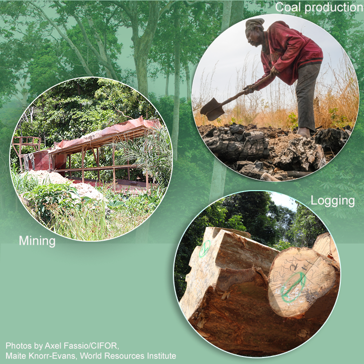
In particular for Ghana, landscapes are under pressure from farmlands expanding into forested regions, and the expansion of cities over forests and agricultural land. In addition, unregulated activities such as galamsey and charcoal extraction may create hot-spots of change that are precursors to further land degradation. Mitigating these deleterious changes and the restoration of ecological function is of major interest to the National Government and several agencies responsible for social, economical, and environmental sustainability.

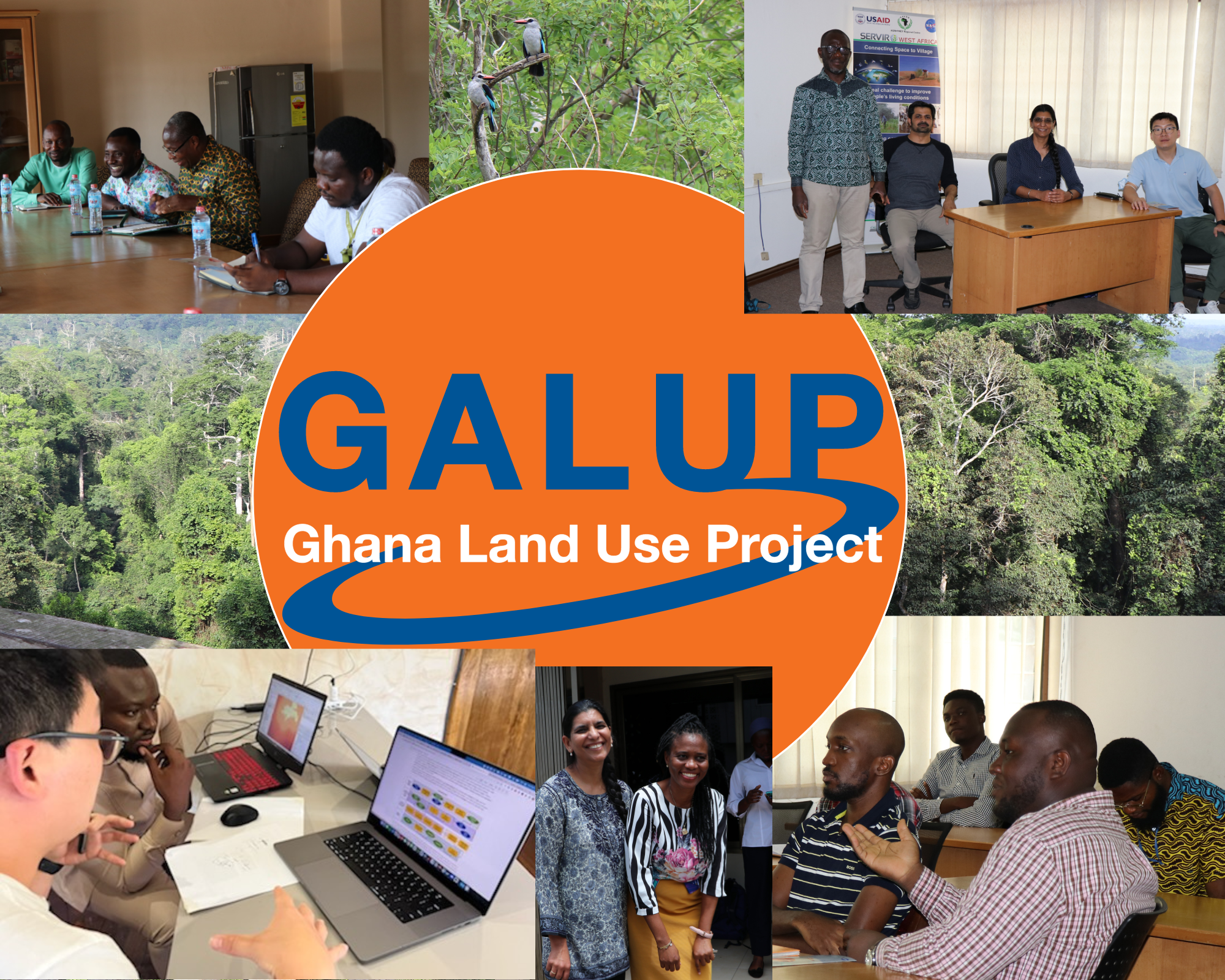
Working in close collaboration with government agencies in Ghana, such as the Land Use and Spatial Planning Authority (LUSPA) and the Ghana Statistical Service (GSS), the Program includes two projects that utilize remote sensing and geographical information systems (GIS) to help inform and guide land management efforts accross Ghana.The land use planning project (GALUP-LUP) aims at understanding the linkages between deforestation, urbanization, and agricultural expansion. The Land degradation assessment project (GALUP-LDAP) aims at developing appropriate technologies to help monitor artisanal mining and charcoal production in Ghana.

The GALUP project has been awarded by SERVIR, a joint venture between NASA and the U.S. Agency for International Development to help developing countries use Earth-observing satellites and geospatial technologies for managing climate risks and land use. It is led by Professor Jasmeet Judge in the Agricultural and Biological Engineering (ABE) Department at the University of Florida (UF), in collaboration with researchers from UF, the Centre for Remote Sensing and Geographic Information Services (CERSGIS) in Ghana, and the University of Ghana. Follow us on Twitter

Capacity Building

One of GALUP’s objectives is to help build local capacity in applying tools empowered by Remote Sensing (RS) and Geographic Information System (GIS) technologies to inform and ensure sustainable land use practices.

Our project includes workshops aiming at helping trainees to familiarize themselves with the use of LUCIS-OPEN, a GIS-based, open-source land use planning framework. 

These training sessions are intended for staff at the Land Use and Spatial Planning Authority (LUSPA) of Ghana. LUSPA develops land use policies and planning frameworks at national, regional, and local levels. In due course, capacity-building exercises will be conducted in collaboration between the University of Florida, the Centre for Remote Sensing and Geographic Information Services CERSGIS, LUSPA, and the representative District Assemblies (DAs) in the Twifo Lower Denkyira District (TLDD) and in the Asante Akim Central Municipal District (AACMD).


about Img

Recent Activities

Visit of GALUP team to Ghana: First stop, we visitied our technical partners at the Land Use and Spatial Planning Autorithy (LUSPA), National Development Planning Commission (NDPC) and USAID in Accra
 
April-May, 2022, was marked by our visit to Accra, and the districts of Twifo Hemang Lower Denkyira and Asante Akim Municipal. Featured on the photo from left to right:

 Rosette Agyekum – Agartha Addo – Theophilus Anum Adjei – Abigail Amankwah – Elvis Mensah – Abena Apeaa Adu – Emmanuel Tetteh-Wayo Nii – Huziemata Yakubu – Patrick Apraku – Barbara Adomaa Kumi – Foster Mensah, Cersgis – Beatrice Owusu-Appiah – Jasmeet Judge, UF – Prosper Kwarme – Chapman Owusu-Sekyere, LUSPA – Joseph Dennis Quarcoo – Enoch Anchebah – Changjie Chen, UF – Celestina Deku – Ama Boadu


about Img


We visited our partners of the Twifo Hemang Lower Denkyira District in the Central Region.

Featured on the photo from left to right:

 Mawuli Doe – Dominic Abakah – Sagito Musah Issaka – Oware Ampomah – Frank Matey Korli – Dr. Aditya Singh, UF – Dr. Jasmeet Judge, UF – Prince Gyabeng – Dr. Changjie Chen, UF – Napoleon Owusu Asante – Elsie Nai –Silas Achidago, LUSPA


about Img


We visited our partners of the Asante Akim Central Municipal District members in the Ashanti Region.

Featured on the photo, from left to right: 

Prince Darkwah, Minerals Commission – Edem Kokou Mawu, EPA – Foster Mensah, Cersgis – Jasmeet Judge, UF – Robert Yaw Kwakye, Chief Executive AAC – Changjie Chen, UF – Gideon Tetteh, Physical planner AAC – Adwoa Obeng, Development planner – Enoch Asem, Minerals Commission – Silas Achidago, LUSPA – Dennis Frimpong, Minerals Commission


about Img


Congratulations to all the participants who successfully completed our online workshops!

In August 2021, thirty-six participants from LUSPA, CERSGIS, Agrhymet and ICRISAT completed our 2nd online training on the Land Use Suitability Analysis with QGIS Tools

In December 2021, forty participants from LUSPA, CERSGIS, Agrhymet and ICRISAT completed our 2nd online training on the Introduction to Satellite Remote Sensing

In June 2022, seventeen participants from LUSPA, CERSGIS, Agrhymet and ICRISAT completed our 3rd online training on the Integrated Decision Units for land use suitability modeling

about Img


Visiting our partners of the NDPC in Accra

Featured from left to right: 

Kofi Ntim - Dr. Nana Opare-Djan - Foster Mensah - Changjie Chen- Jasmeet Judge- Jonathan K. Azasoo - Angela Yarboi - Chapman Owusu-Sekyere - Silas Achidago – Harriet Doghle – Wilfred E. Sam-Awortwi – Silas Owusu Asante - Elvis Ocansey


about Img


Visiting our partners of USAID in Accra

Featured from left to right:

Chris Schaan - Foster Mensah - Matthew Anderson - Jasmeet Judge - Changjie Chen - Aditya Singh - Halima Ouattara-Ayanou


about Img

Ghana Land Use Project (GALUP): Overview

Ghana Land Use Project (GALUP): Geospatial tools and Capacity building

Objectives

Objectives of GALUP

The goal of the Ghana Land Use Program (GALUP) is to provide an effective planning framework to land managers in Ghana. The framework will integrate remote sensing and Geographic Information Systems (GIS) to model the linkages between deforestation, urbanization and agricultural expansion in the country. The project will also identify potential conflicts between different land uses, such as agriculture, mining or conservation, and predict land-use change scenarios.

Recent Activities

Coming up in January 2023: new project for GALUP on Land Degradation

GALUP was awarded a new grant by NASA to detect and monitor risks of artisanal mining and charcoal production in Gha…

Read more