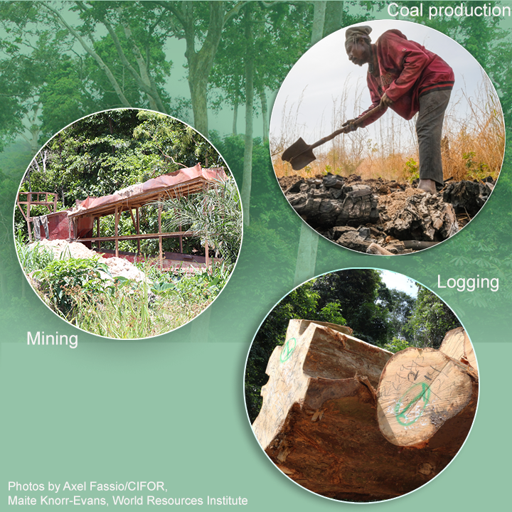
GALUP was awarded a new grant by NASA to detect and monitor risks of artisanal mining and charcoal production in Ghana. Entitled "Integrating Socio-Economic and Remotely Sensed Information to Characterize Conflict Precursors and Land Degradation Dynamics in Ghana", this project will be using remote sensing to develop a land use conflict identification and land degradation framework.
It will combine images collected by drones and satellites with high-resolution socioeconomic data to monitor land degradation and deforestation in the country.
The new project builds on a series of mapping tools developed by the Ghana Land Use Program (GALUP) at the University of Florida since 2020. Using cutting-edge technologies, it will develop a web-based application that allows stakeholders to assess land use conflict in their region and contribute to better inform spatial planning policies in Ghana.
The project is led by Dr. Aditya Singh of UF Agricultural and Biological Engineering (ABE) with Dr. Jasmeet Judge (ABE), Dr. Changjie Chen (Urban and Regional Planning), Dr. Olivier Walther (Geography) and Dr. Gregory Kiker (ABE). In Ghana, the UF team will work closely with the Centre for Remote Sensing and Geographic Information Services (CERGIS), the University of Ghana, the Ghana Statistical Service, and the University of Cape Coast.
Funding for this project comes from SERVIR, a collaborative venture between NASA’s Earth Science Division Applied Sciences Program and the United States Agency for International Development (USAID).
Contact: Dr. Aditya Singh, aditya01@ufl.edu